
















In the face of increasingly frequent and severe wildfires, understanding the operational challenges faced by firefighters is crucial for business owners in California. The notion that fire trucks are systematically turned away during emergencies is a concern that cannot be overlooked, potentially impacting local businesses during times of disaster. Throughout this article, we will explore the realities of fire truck accessibility during wildfires, detailing the access challenges they encounter, the logistical issues that arise, the effect on infrastructure, and how California’s approach compares to other regions. Our final chapter will delve into emergency response protocols that are designed to ensure the safest and most efficient operations for fire responders. By dissecting these aspects, business owners can gain deeper insights into the complexities of wildfire response and the implications for their communities and operations.
Access Under Fire: The Realities of Fire Truck Reach Through California’s Wildfire Seasons
Rumors about fire trucks being turned away at gates during wildfires are common, but the real picture is more nuanced. California’s wildland-urban interface tests every responder’s ability to move rapidly through diverse terrain, manage evacuation traffic, and position resources where danger is evolving. There is no state-wide mandate that gates are always closed; instead, access becomes a dynamic negotiation among fire, law enforcement, transportation agencies, and residents as flames push across hills and neighborhoods.
Road design—narrow lanes, limited turnarounds, private drives, and uneven pullouts—often shapes how quickly engines can reach a scene. In dense urban fringes and remote stretches alike, responders must adapt routes in real time, sometimes rerouting to avoid bottlenecks or to protect critical evacuation corridors. The pattern is not gatekeeping but logistics under pressure: keeping critical egress for residents usable while ensuring suppression units can perform their tasks.
The practical takeaway is that improved resilience comes from planning ahead: wider roads where feasible, clearer signage for emergency routes, maintained driveways, and multi-agency incident command that can reassign routes as conditions change. When communities invest in these design and planning measures, the chance that a fire truck will reach a home in time increases, even as the fire itself behaves unpredictably.
On the Edge of Access: How Logistics Shape Fire Truck Movement in California’s Wildfires
When flames lick up the foothills and smoke thickens along canyon rims, the question that often arises is not simply whether fire trucks are allowed through a checkpoint, but how they are supposed to navigate a landscape that itself is being reshaped by danger. The idea that a gate might bar a vehicle carrying potentially life-saving equipment connotes a binary, almost administrative obstacle. In practice, the challenge is more nuanced. Access to affected areas during California’s large wildfires hinges on the physical realities of roads, the integrity of bridges, and the dynamism of evacuation orders, all of which can shift in a matter of hours. The outcome is not a single scene of a truck turned away at a gate, but a spectrum of logistical hurdles that can slow, reroute, or temporarily stall a response at crucial moments. And while such difficulties are nowhere near unique to California, they illuminate a shared truth of modern firefighting: mobility in a wildfire zone is as much about infrastructure and coordination as it is about courage and churning engines.
In recent fire seasons, emergency responders have confronted a recurring tension that sits at the heart of any rapid-response operation: the tension between urgency and safety. Large wildfires demand swift ingress into rapidly evolving fire fronts, but the very roads and corridors used to move people and equipment are often the first things to fray when a fire expands. Narrow, deteriorated roads that can’t bear the weight and turning radius of heavy apparatus become choke points. A hillside community with limited culverts may experience a conflict between traffic flow for evacuations and the need for clear lanes for fire apparatus to pass in both directions. When debris from a windstorm, a fallen tree, or a rockslide blocks a route that is already under pressure from smoke and heat, responders face a binary choice: wait for a safe clearance or seek a longer, less efficient path that still keeps critical work progressing. These decisions are rarely simple and typically involve real-time assessments by incident command, transportation authorities, and local law enforcement. What emerges is a picture of access that is fluid and contingent rather than a straightforward gatekeeping tableau.
The public record does not indicate a pattern of systematic denial of access to California fire scenes. Instead, it points to a more granular reality: episodic delays caused by logistics, geometry, and competing demands on the same stretch of road. In remote or rugged terrain, the physical footprint of a wildfire—broken pavement, collapsed lanes, and widening emergency zones—can transform a two-lane arterial into a constricted artery that slows tactical moves. Even when no gate is closed, the timing of entry becomes a careful calculation. Fire crews must align with weather windows, fuel continuities, and evolving evacuation zones. This coordination requires a mosaic of permits, closures, and re-openings that can flex minute by minute. The upshot is not deliberate obstruction but the friction of arranging multiple moving parts in a high-stakes environment.
A concrete illustration from the 2023 Palisades Fire in Los Angeles County underscores how these dynamics unfold on the ground. Reports tied to that event describe fire trucks arriving at or near congested corridors where multiple agencies were attempting to synchronize their movements. Road congestion, shifting closures, and impassable conditions created delays that forced crews to reroute or wait for clearance before advancing toward active flame fronts. Importantly, observers and officials framed these circumstances not as refusal but as operational realities—areas with heavy traffic during evacuations and limited access points present a higher likelihood that responders are temporarily slowed. It is a reminder that even with trained personnel and well-maintained fleets, the pathways to hazards are often the limiting factor. The broader takeaway is not one of fault but of the need for more resilient systems to support rapid ingress when seconds count.
The architecture of access in California wildlands rests on a few interlocking pillars: road networks, incident management protocols, and the sequencing of evacuations. California’s vast mix of urban, suburban, and rural geographies means that there is no single route that suits every fire incident. Wide, multi-lane freeways may become overloaded with evacuees and fewer lanes available for apparatus, while narrow rural roads may be entirely unsuitable for the largest fire engines. This is not a problem of neglect but of scale and topography. When a fire grows, the surrounding infrastructure carries the weight of new demands: shuttling residents to safety, delivering water and fuel to staging areas, and providing the lifelines for incident command teams to coordinate suppression efforts. In such conditions, a meticulous plan for vehicle movement is as vital as the water supply or the aerial resources that often capture the public imagination during a blaze.
The importance of pre-planned routes and real-time coordination becomes evident when one considers the role of traffic management in emergency response. Evacuation flows and rescue operations do not simply require that a road be open; they demand that it remain navigable for the duration of the incident. Traffic control devices, temporary closures, and law enforcement officers working alongside fire personnel create an extended corridor for response. This is a dynamic ballet rather than a static gate. When new hazards appear or when the wind shifts direction, the preferred routes can change. Responders frequently must swap to alternative corridors, adjust staging locations, and reposition ground units to preserve access to the most critical sectors of the fire while still maintaining safety for civilians and responders alike. In many ways, the success of a firefighting operation hinges on the choreography of these routes as much as on the engines rolling toward the flames.
The experiences from California’s 2023 and 2024 fire seasons have also illuminated the value of interagency collaboration and data-informed decision-making. Modern response networks rely on shared situational awareness: incident maps, real-time traffic feeds, and the ability to project how road conditions will evolve in the coming hours. When road closures are announced or adjusted, the clock starts on recalibrating response plans. This is where logistics reach into strategy. The most effective actions come not from heroic single moves but from coordinated deployments that align vehicle access with the evolving geometry of the fire’s path. In practical terms, this means pre-established mutual-aid frameworks, standardized communications, and interoperable protocols that allow teams from multiple jurisdictions to operate as a single unit. It also means robust transportation planning that anticipates capacity constraints, explores multiple ingress routes, and builds redundancy into the system so critical responders aren’t left waiting for a window that may never appear.
For readers who want to visualize the kinds of equipment that operate within these logistical ecosystems, it helps to think beyond the gate and toward the broader fleet that supports suppression work. Large and small apparatus, from heavy-duty trucks to aerial platforms and support vehicles, must be able to traverse the same corridors that residents use during evacuations. The ability to move multiple units efficiently depends on thoughtful road design, appropriate clearance for bridges, and the availability of staging points where equipment can be pre-positioned ahead of a shift in fire behavior. In this context, the question of whether fire trucks were turned away is less a matter of gatekeeping and more a measure of how accessible the landscape remains to responders under stress. The truth lies in the ratio of available routes to the number of assets in play at any moment, and in the decisive actions taken to keep those routes open when pressure mounts.
As the firefighting community reflects on past incidents, one clear implication emerges: infrastructure planning and real-time coordination deserve ongoing attention. When planners imagine future wildfire responses, they must consider how to safeguard the arterial routes through which both civilians and responders move. This includes strengthening road networks where practical, improving debris-clearing capabilities, and enhancing partnerships with transportation authorities to enable rapid, temporary changes to lane assignments and signal timing. It also means expanding pre-planned corridors that can be quickly activated for emergency movements, akin to dedicated emergency lanes during evacuations. The lessons are practical, and they point toward a future where the emphasis is on resilience and adaptability—where the focus is on preserving access even as fires push the landscape toward hazard.
Within the broader discourse on wildfire response, readers may encounter discussions about equipment and vehicles suited to these demanding environments. For a sense of the kinds of equipment that mobility and logistics teams rely on during operations, consider exploring the fire fighting truck category, which catalogs a range of apparatus designed to strengthen on-scene capabilities and movement through challenging terrain. This reference helps connect the logistical realities described here with the tangible tools teams deploy under pressure: heavy-duty trucks, mobility-assisted platforms, and support vehicles that extend the reach of suppression efforts. The essential point is that access is not incidental to success; it is a strategic component of the suppression equation—one that requires foresight, coordination, and continuous investment in the networks that keep roads usable even as fires threaten to overtake them.
For readers seeking authoritative, ongoing incident data and updates on active fires, the official records maintained by state agencies provide the most reliable window into how access is managed in real time. CAL FIRE publishes incident reports and maps that illustrate how response priorities evolve with the fire’s trajectory and the surrounding traffic environment. These sources underscore a practical reality: while stories may surface about delays or reroutes, they are best understood when framed through systematic data about road conditions, closures, and the sequence of suppression actions. Taken together, the picture that emerges is one of dynamic problem-solving, where access is constantly renegotiated in the face of hazard, rather than a simple yes-or-no question about gate access.
External resource: https://www.fire.ca.gov/incidents/
Internal reference for equipment context: fire fighting truck category
Bridging the Flame: How California’s Roads and Infrastructure Shape Fire Truck Access During Wildfires
When people ask whether fire trucks were turned away in California, the straightforward answer is that there is no verified, statewide pattern of gates closing and trucks being refused entry. Yet that question points to a more intricate reality: access to burning landscapes is governed by a web of roads, closures, and terrain that can complicate even the best-laid plans. In California, as in many fire-prone regions, the challenge is less about a single gate and more about the dynamic system that carries responders, hoses, and water uphill, sometimes through neighborhoods that lay at the edge of a rapidly advancing blaze. The absence of a documented policy of being turned away does not mean the problem is nonexistent. Large wildfires, especially during peak seasons, reveal how access can be hindered by road closures, hazard conditions, or infrastructure damage. These barriers are not about intent; they are about physics, logistics, and the realities of delivering life-saving response in environments designed for human scale and not for mass extinguishment at the edge of a firestorm. The broader context matters because it frames how agencies prepare, coordinate, and improvise when time is measured in minutes rather than hours. This is not a tale of gatekeeping but of movement under pressure, where every mile can influence outcomes for people at risk and for the firefighters who risk theirs to save them. The reference points that help ground this discussion include national and regional reporting on wildfires, along with official sources that track incident status and response actions. For real-time updates on fire response operations in California, the authoritative channel remains Cal Fire, which maintains incident information, maps, and status updates to inform both responders and communities. Although the dramatic scenes from other states sometimes color public perception, the California firefighting ecosystem operates with a high degree of interagency coordination, mutual aid, and standardized incident command practices designed to preserve access wherever possible. These realities matter because they shape how infrastructure is planned, how roads are maintained, and how the public can understand the nuances of response during extreme fire events.
California’s road network is a critical, sometimes invisible, collaborator in any firefighting effort. The state’s geography—ranging from dense foothill communities to expansive rural tracts and rugged coastlines—demands a patchwork of routes that must accommodate heavy apparatus, water supplies, and rapid personnel movement. In practice, the condition and design of roads influence both suppression and evacuation operations. It is common for rural or wildland-urban interface (WUI) corridors to feature narrow, winding layouts with limited turning radii and frequently a single lane in each direction. These characteristics, while perfectly functional for daily traffic, can become serious impediments when a fire demands rapid, large-scale ingress. The problem is not simply the width of a street but the combination of width, grade, curves, and the way a road intersects with hillside topography or unstable slopes. When a firefighter commander asks whether a particular route can support a heavy brush rig, a water tender, and a ladder truck simultaneously, the answer often hinges on the cumulative effect of these road attributes. In some cases, a road may be technically passable, yet the maneuvering space required for a large apparatus makes it impractical to attempt a full, two-way approach at the scene. The result is not a closed gate but a cautious, incremental approach to access that prioritizes life safety and the prevention of blocked escape routes for residents.
The daily operations of fire agencies in California reveal another layer of complexity: post-fire conditions. Even after flames have been contained or suppressed in a given area, the ground can still be unstable, and roads can be compromised by ash deposition, downed trees, burned embankments, and debris flows. A paved arterials might appear intact, yet its substructure could be weakened, creating a hazard for heavy vehicles that require stable roadbeds and predictable traction. Debris clearance and structural assessments become essential steps before a large-scale push on a particular corridor can continue. In these moments, access decisions hinge on real-time assessments rather than on preexisting plans alone. The dynamic nature of fires in steep landscapes means that a route viable in the morning can become compromised by afternoon weather shifts, shifting winds, or post-fire rainfall. The interplay between suppression tactics and road safety thus becomes a continuous calculus, with responders balancing speed, safety, and the long-term objective of keeping communities protected.
In examining resilience, researchers and practitioners point to several strategies that align with both the constraints of California’s terrain and the demands of rapid fire response. One area of emphasis is the strategic use of data and modeling to anticipate where access might fail and to identify choke points in advance. Generative AI modeling, for example, is being explored as a way to simulate road network performance under fire scenarios. By feeding in variables such as expected fire spread, wind direction, road grade, and ongoing closures, these models can reveal which routes are most likely to remain viable and where contingency paths should be pre-positioned. The goal is to map resilience into the infrastructure itself: to know which segments of the road network require upgrades or preemptive clearing, and to determine how to stage resources so that if one corridor becomes unsafe, another remains ready to carry the brigade through.
Equally important is the practice of identifying choke points before they become bottlenecks. A choke point might be a narrow bridge, a single-lane canyon road, or an interchange that cannot handle the influx of emergency traffic during a large incident. By pinpointing these vulnerabilities, agencies can prioritize upgrades—paving improvements, widening certain segments, or installing better signage and traffic control measures—to preserve throughput when it matters most. The concept extends to planning alternative routes that retain viability during evacuations or suppression operations. If a primary artery is compromised, responders need to know which secondary corridors can support the same volume of traffic without introducing dangerous delays. This is not a theoretical ideal but a practical imperative that informs regional planning, mutual-aid agreements, and the allocation of maintenance funds. It is a forward-facing approach that recognizes the road network as a critical asset in the firefighting toolbox, not merely as a conduit for vehicles.
Data-driven strategies feed into the broader effort to maintain accessibility. Road condition data, weather patterns, and incident history combine with real-time intelligence to shape decisions about where to position engines, water tenders, and specialized units. Agencies increasingly rely on coordinated information sharing with local jurisdictions, highway authorities, and utilities to clear routes and ensure safe passage for emergency responders. Across these efforts, a common thread is the understanding that infrastructure resilience is inseparable from tactical response. The better the roads are maintained and the more adaptable the routing plans, the more quickly crews can arrive at the scene, establish a perimeter, and begin suppression or evacuation operations. The aim is not to eliminate risk but to reduce it by ensuring that the physical framework can support the operational tempo required during severe fire events.
To place these ideas in a practical frame, consider how a department might think about access in a complex, fire-prone county. The plan begins with a network assessment: which streets and lanes are essential for two-way firefighter movement to critical neighborhoods, which choke points could block that movement, and where to locate staging areas for equipment so that no single road becomes a bottleneck. It continues with proactive maintenance and upgrades tailored to high-risk zones, including reinforcing vulnerable segments, improving drainage and slope stability, and designing evacuation routes that remain functional even when neighboring corridors are compromised. It also incorporates proactive incident planning—preparing alternative routes and ensuring there are pre-identified points for water supply, pump operations, and air support if needed. And it embraces technology: scenario-based simulations, predictive analytics, and AI-assisted routing to anticipate the path of least resistance through a landscape that can shift from ally to obstacle within hours. In this sense, infrastructure is not just a backdrop; it is a dynamic partner in the mission to protect life and property.
Within this framework, a concrete reminder about context is useful. The Maui Lahaina wildfire reports, widely cited in national outlets, illustrate how even in well-developed urban and suburban settings, access can be compromised by blocked roads and rapidly spreading flames. While that case occurred in Hawaii and not California, the underlying lesson—roads becoming barriers to access under extreme fire conditions—applies broadly. It highlights why California agencies emphasize contingency planning, open lines of communication, and rapid interagency coordination to keep access flowing wherever possible. The bottom line is not about whether a gate existed or whether a particular gatekeeper allowed entry; it is about ensuring that the road network, the equipment, and the people who carry out the work can operate together when the fire demands maximum throughput.
As this chapter closes, the conversation shifts from the binary question of gate access to the more nuanced question of how infrastructure and strategic planning shape every response. The road system is a lifeline for firefighting operations, and its resilience is measured not by a single moment of entry but by the sustained ability to move, to clear, to evacuate, and to pursue suppression with confidence that the path ahead will hold up under pressure. This is the connective tissue that unites the physical world of pavement and bridges with the human world of incident command, mutual aid, and community protection. For readers who want to explore a related dimension of equipment and its role in maintaining access, consider the road-wrecker-truck category as a reminder that specialized hardware exists to keep lanes passable even when nature or disaster tests the street network. road-wrecker-truck category.
In sum, while there is no verified evidence of systematic gate denial of fire trucks in California, terrain, road design, and post-fire conditions create real and ongoing accessibility challenges. The contemporary approach combines proactive infrastructure investment, data-driven planning, and interagency coordination to preserve access in the face of growing wildfire pressure. The goal is not a simplification of the problem but a strengthening of the system that makes access possible when every second counts. Communities are served best when the public understands that access during wildfires depends on a network of roads engineered for resilience, navigated by practiced responders, and supported by intelligent planning that anticipates choke points before the flames reach them.
External resource: ScienceDirect study
Access Without Gatekeeping: Fire Truck Mobility in California During Wildfire Crises
Did fire trucks get turned away in California? The short answer is no; there is no statewide policy that systematically blocks access for emergency vehicles. In practice, access during wildfires is a function of road conditions, incident demand, and real-time coordination among agencies. Road closures, hazardous terrain, smoke, and damaged infrastructure can cause delays, but the goal is to preserve life and property while keeping critical vehicles moving when possible.
California relies on a robust mutual-aid network and standardized incident command structures to move engines, ladder trucks, and support units where they are most needed. Dispatch centers work with law enforcement, transportation agencies, and road maintenance to clear corridors, designate staging areas, and reroute traffic to minimize bottlenecks. Decisions are data-driven and adapt as the fire expands, with routes revised to maintain access to high-priority points along the fire perimeter.
Digital tools provide a living picture of unit locations, resource deployments, and evolving conditions. Shared situational awareness helps reduce duplication, shorten response times, and improve route selection. When access is constrained, responders can identify alternative corridors and forecast delays, reallocating assets before bottlenecks become critical. The outcome is a more resilient response that keeps engines and crews moving toward the front lines.
The experience in California is complemented by clear public information from Cal Fire and local agencies. Incident maps, road-condition updates, and evacuation guidance steer civilian traffic away from emergency corridors and toward safer routes, reducing interference with operations. While occasional delays are unavoidable during fast-moving wildfires, there is no systemic gatekeeping; the emphasis remains on safety, speed, and coordinated action across agencies.
5. Keeping the Doors Open: How California Safeguards Fire Truck Access During Wildfires
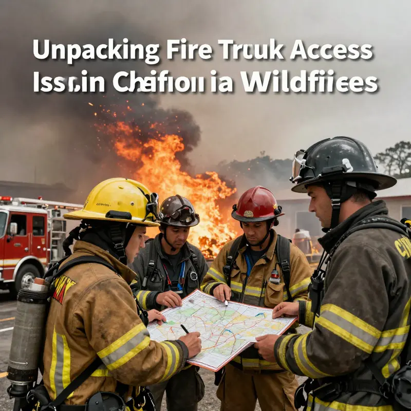
When the question is asked, did fire trucks get turned away in California, the instinct is to picture gates, checkpoints, or sudden refusals at a barrier. In reality, the story is more nuanced. California’s wildland firefighting reality is less about closed doors and more about dynamic access management. The state has built a layered system that emphasizes rapid deployment, clear lines of authority, and continuous risk assessment. This framework aims to ensure that, even as fires intensify and landscapes become rugged or remote, fire engines and the crews charged with protecting lives and property can reach critical zones as swiftly and safely as possible. There is no verified pattern of systematic denial of entry to fire apparatus at a gate or official checkpoint. What does exist, and what the public should understand, are the operational realities of large-scale fires and the measures designed to minimize delays while preserving safety for responders and residents alike.
From the moment a wildfire is detected, the priorities are straightforward: mobilize the right mix of resources, establish command and control, and create a plan that can adapt as conditions change by the hour. The initial response typically involves dispatching fire engines and other apparatus from nearby departments and state units. The aim is a direct attack that can slow or stop a fire before it becomes unmanageable. This early-stage strategy relies on the availability of roads, fuel, and crews that can move quickly into the risk zone. Yet even with rapid dispatch, the terrain of California’s fire-prone regions—steep grades, narrow canyons, and dense brush—can complicate access. In those moments, decisions shift from “how do we reach the fire?” to “what is the safest way to reach it while preserving the ability to operate effectively once there?”
To manage growing incidents, the system escalates through established channels. Resource mobilization is coordinated through the National Interagency Fire Center (NIFC) and interagency agreements that tap Type 1 and Type 2 engines, air support, and specialized personnel. The emphasis is not on preventing access but on coordinating a broader task force so that the right tool is available at the right time. The goal is to avoid bottlenecks that could delay critical interventions, whether that means reinforcing a line with additional engines, bringing in a water-dattering tactical capability, or providing air support where ground access is compromised. In practice, this means that even when certain routes are temporarily unusable due to road conditions, hazards, or firefighting operations, crews are rerouted, re-routed, or repositioned to maintain momentum toward containment objectives rather than being blocked at a single chokepoint.
A central feature of California’s approach to access is situational awareness at multiple scales. Command centers fuse satellite data, aerial reconnaissance, ground sensors, and weather forecasts to construct a living picture of where a fire is moving, where hazards are most acute, and where safe ingress and egress for responders can be maintained. Fire trucks are equipped with GPS tracking and two-way communications to stay in contact with incident commanders and to adapt paths in real time. This real-time visibility helps ensure that response teams are not anchored to a single plan that may become obsolete within minutes. Instead, there is a continuous assessment of whether a given route remains viable or whether an alternative corridor must be opened to preserve both speed and safety. The result is a flexible network of routes and staging areas that can absorb shifting conditions without forcing crews to halt for extended periods.
Safety is not a backdrop but the central driver of every decision. The discipline of safety action guidelines is embedded in every phase of deployment. Firefighters do not enter high-risk zones without a documented assessment, proper protection, and supportive infrastructure that can sustain operations. In practice, this translates into a cautious but deliberate approach to access. If a road is compromised by fire intensity, falling trees, or hazardous fuels, incident managers may limit vehicle movement through the affected zone and instead redirect resources to a safer route. Such decisions may create the appearance of a delay, but they are fundamentally about preserving lives—both of the public and of the personnel who respond. The purpose is not to minimize the number of fire trucks in the vicinity but to optimize the safety and effectiveness of those trucks once they arrive on scene.
Interagency collaboration is the backbone of this access philosophy. Large incidents demand a unified command structure that unites federal, state, and local agencies under a common set of objectives and terminology. Standardized resource typing and mutual aid agreements enable a smoother flow of equipment and personnel across jurisdictions. The Camp Fire in 2018 and the August Complex Fire in 2020 are frequently cited as laboratories for this kind of collaboration. In those events, teams from multiple agencies operated under a coordinated framework that allowed engines, water tenders, and aerial assets to be allocated where they were most needed, based on real-world conditions rather than on jurisdictional boundaries. The net effect is a system that can move efficiently despite the complexity of the landscape and the scale of the emergency.
The narrative around access also includes continuous improvement. After-action reviews and formal debriefings identify where response times can be shaved without compromising safety or reliability. These evaluations have led to refinements in planning, communication, and logistics. Rather than a static playbook, California’s response protocols are iterative, reflecting new firefighting technologies, evolving weather patterns, and the hard lessons learned from major incidents. It is this dynamic, evidence-based evolution that sustains the capacity to react promptly to rapidly changing conditions—conditions that can turn a mere delay into a major setback if not managed with precision. In practice, the system’s strength lies in its redundancy: multiple routes, diverse types of equipment, and a spectrum of trained personnel that can be deployed from neighboring regions when local resources are stretched.
The public often absorbs a snapshot of events during a wildfire—images of burned neighborhoods, road closures, and firefighters racing toward a rapidly spreading flame front. Those images can feed a perception that access is being blocked or that fire trucks are being turned away at the threshold of danger. Yet the evidence, when examined across the scale of hundreds of incidents over many fire seasons, points toward a different conclusion: while access challenges arise, systematic denial at entry points is not a standard practice. Road closures are commonly a matter of safety, not gatekeeping. A road might be closed to ensure that only essential traffic can move through a zone with active fire or structural collapse. In such cases, the decisions are driven by the same calculus that governs any emergency evacuation or shelter-in-place order—protect as many people as possible while facilitating a controlled, predictable response. The difference between a closure and a refusal to allow entry lies in the intent and the scope of the closure, not in a general prohibition against fire trucks entering an affected area.
For residents and observers seeking up-to-the-minute guidance on a particular wildfire, the official channels remain the most reliable source. Updates are posted as incidents evolve, and the information environment is curated to reflect the current risk, containment progress, and operational priorities. The publicly accessible hub for incident information emphasizes the imperative of transparency and timely access to credible data. As part of the ongoing conversation about access, it is important to recognize that the coordination that keeps fire trucks moving is nested within a broader public-safety ecosystem. This ecosystem includes traffic management, evacuation planning, and infrastructure repair, all of which interact with firefighting operations in real time. The goal is not just to fight a flame but to preserve the community’s overall resilience by sustaining a coherent, layered response that can adapt when conditions demand it.
In this context, talking about access becomes a way to understand a larger truth: emergency response is a system, not a single act. The dispatch that starts a chain reaction, the interagency coordination that aligns unfamiliar jurisdictions, the situational awareness that foresees a dangerous turn and pivots to a safer route, and the safety culture that prevents crews from taking reckless risks—these elements together form the architecture that keeps fire trucks moving toward the line. When people ask whether fire trucks were turned away in California, the answer must be filtered through the lens of this architecture. Yes, there are moments when access is constrained by road conditions or danger, and redirection or delays occur. No, there is no evidence of a deliberate, systemic policy to turn away fire apparatus at borders, gates, or checkpoints. In fact, the opposite is true: access is actively managed to keep the tempo of response steady even as the landscape grows fiercer.
As real-time updates continue to roll in during a wildfire, the public can consult the authoritative incident information portals and the coordinating bodies that explain how decisions about routes and staging areas are made. In the field, the principle remains simple: reach the fire fast, but reach it safely and with a plan that preserves the ability to operate once there. The practical consequence of this philosophy is that fire units tend to be relocated and resourced in a way that minimizes waiting and maximizes on-site effectiveness. This approach reflects a commitment to preventing the kind of cascading delays that could escalate a fire’s growth, endangering more lives and complicating later containment. While the media may spotlight dramatic moments of obstruction or confusion, the operational record across California’s fires reveals a disciplined, adaptive system designed to keep doors open for emergency responders rather than shut them.
For those who want to dig deeper into the mechanics behind these protocols, the central node of information remains the official state site that hosts incident status, maps, and incident-specific guidance. You can find ongoing incident updates and general guidance at fire.ca.gov. This site serves as a touchpoint for communities seeking authoritative explanations about how access decisions are made, where to find shelter or evacuation information, and how responders coordinate across borders to protect people and property. The resources gathered at this site feed into a broader national conversation about how interagency coordination and ground-truth situational awareness translate into tangible outcomes on the ground. For readers seeking a wider lens on interagency practices beyond a single state, the National Interagency Fire Center offers a complementary perspective on how multi-jurisdictional teams harmonize their efforts when wildfires cross lines and demand a unified response. External resource: https://www.nifc.gov
Final thoughts
Navigating through the complexities of fire truck accessibility in California’s wildfires reveals a landscape fraught with challenges that can significantly affect response efforts during critical emergencies. While assertions of fire trucks being turned away may stem from isolated incidents and miscommunications, the overarching issues relate to access challenges due to hazardous conditions and infrastructure damage. By understanding these factors, business owners can better prepare for the realities of wildfire risks, advocate for improved infrastructure, and support local emergency services. The proactive engagement with fire response protocols will not only assist businesses during disaster recovery but also bolster community resilience in the face of future challenges.

